August 31, 2019
In
Outdoor Edventures
Headwall Lakes Hike
Where:
- Headwall Lakes
When:
- August 31, 2019
Who:
- Ed, Jace, Joey, Ian, Lisa
Trailhead:
- take the Spray Lakes Road from Canmore for 46 km (about 45 minutes) until you reach the turnoff on the left-hand side for the Chester Lake parking lot (the Burstall Pass parking lot is across the road)
- the trailhead starts out of the NE corner of the parking lot just to the left of the washrooms (there is an alternate route out of the SE corner of the parking lot, and we generally return via this route)
- be careful you do not start on the Chester Lake trailhead which is to the left of the Headwall trailhead
Trail notes:
- 650 meters of elevation gain and a 16 km out and back to the upper lake
- the trail starts as a gentle climb on an old logging road that was also once used for cross country skiing
- the initial few km are in the trees with somewhat limited views, but a great smell of the forest and some rabbits sitting on the trail
- after 3 km you cross a bridge and climb a short hill
- as you crest the hill there is a marker on the left-hand side of the trail where you enter the narrower and well worn Headwall trail (there are currently a bunch of rocks spread across the trail to show you not to go any further on the logging road)
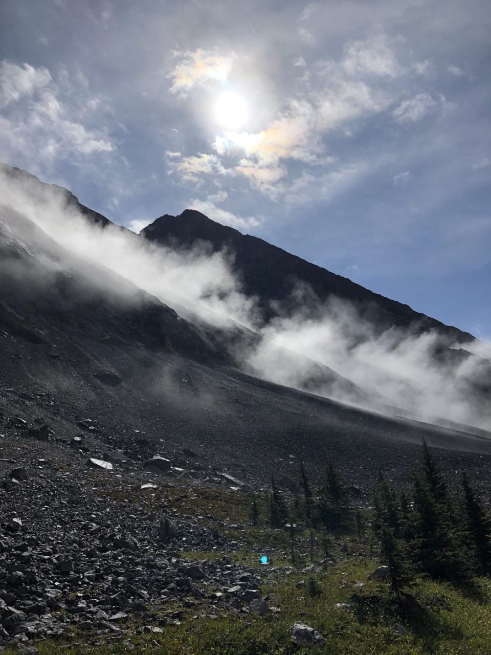
- from here the trail meanders thru thicker forest until you come to a couple of avalanche chutes
- after these two chutes, you start a very steep ascent to the lower lake that is not for a timid hiker
- we slid back a few times on this climb due to the steepness and wet conditions along with some falls on the way down
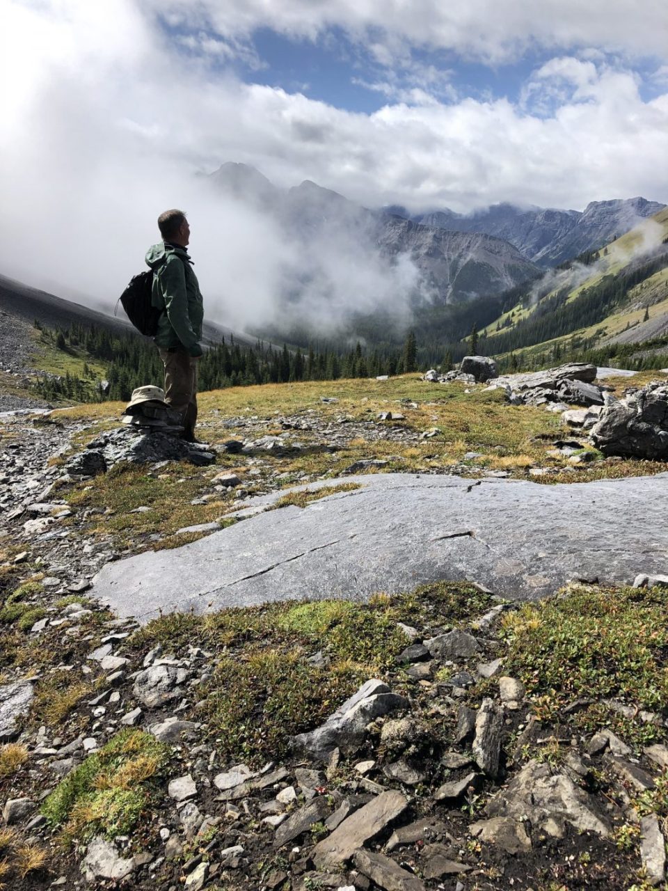
- after the second (upper) lake you can extend the hike deeper into the valley for another km and 170 meters of elevation gain
- the hike took us four hours
- this trail is a moderate to advanced hike as most of the trail is fairly gentle, but the ascent to the lower lake is very tricky
Interesting notes:
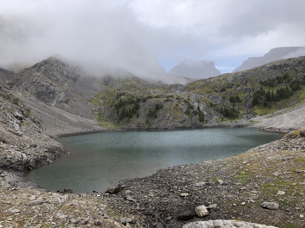
- on this day we only made it as far as the lower lake due to a thunder and lightning storm that caused us to hunker down for 15 minutes under a rock ledge at the base of the lower lake
- given the uncertain weather we decided to turn back down the valley as it was the third storm we had encountered since gathering at my Canmore abode
- a good portion of the initial part of the trail is in the forest, so the stunning views do not start until you break out a couple of km before the lakes
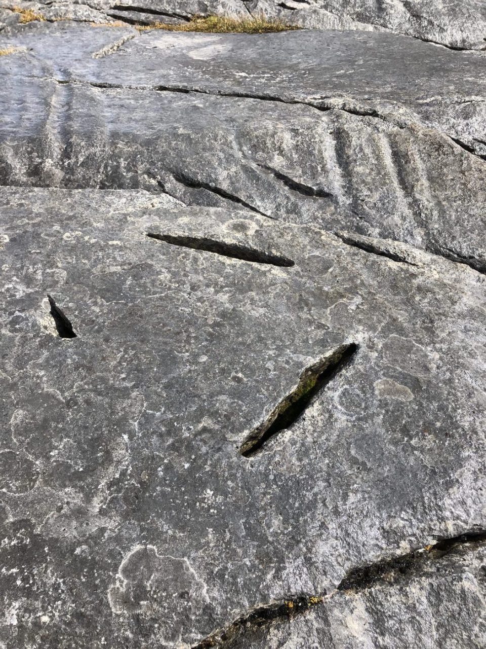
- I love the rock in the upper valley with some amazing shapes, massive slabs, and huge boulders
- the lakes are nestled between Mount Chester, The Fortress, Mount Inflexible, and Mount James Walker
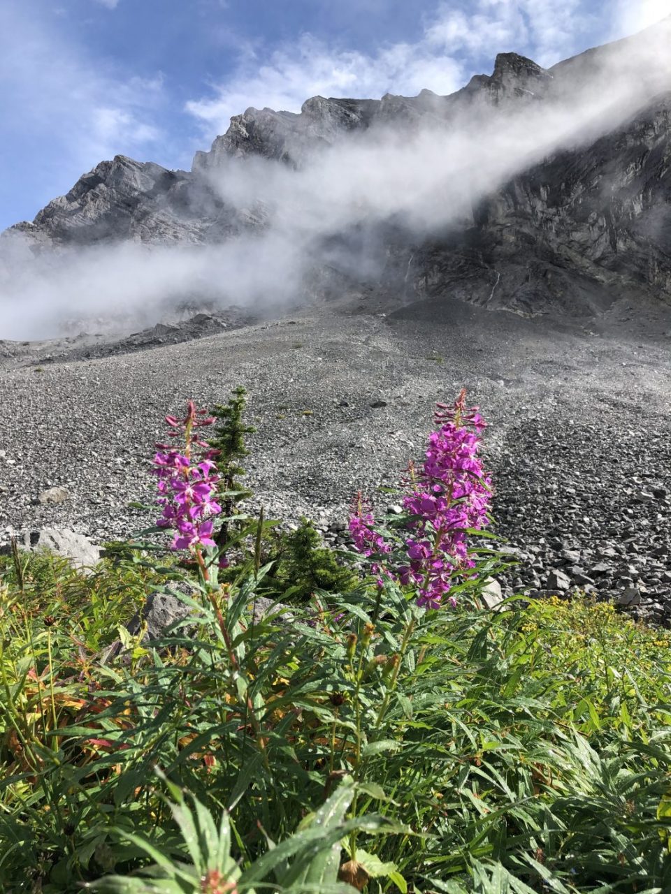
- the rock area before the climb to the lakes contains what is known as ‘whale limestone’ and numerous fossils of which our crew found one
- if you have time and the conditions allow for it, the hike over the pass and back thru Chester Lake is very scenic but takes 6-7 hours
- despite being the long weekend, the inclement weather scared off some hikers, so we only encountered two other groups
- this trail is a good alternative to Chester as it is generally much less busy, but still very scenic