August 29, 2019
In
Outdoor Edventures
Mt. Robson/Berg Lake Backcountry Trip
Where:
- Berg Lake/Mt. Robson
When:
- August 23-26, 2019
Who:
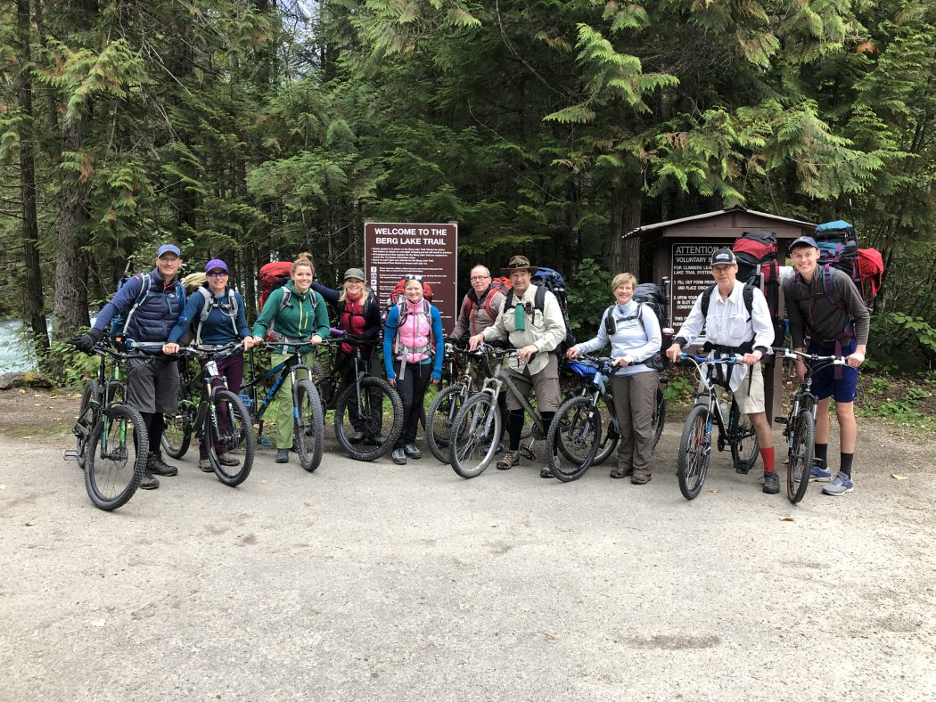
- Ed, Michael, Rohan, Geoff, Lynn, Sasha, Feiko, Gerard, Carolyn, Stephanie, Toni
Trailhead:
- drive 75 km west of Jasper on Highway 16 into Mt. Robson Provincial Park (it took us an additional 15 minutes on the way out and 20 minutes on the way back due to construction)
- we had to check-in at the Mt. Robson Visitor Center and went thru a brief orientation and instructional video
- from the Visitor Center, you drive 2 km up a side road to the trailhead
Trail notes:
- we chose to helicopter in some of our gear which lessened the load on our backpacks
- Feiko was kind enough to accompany the gear since we could not leave it unattended at the drop off spot
- he ended up having the toughest assignment as he had to make four separate trips lugging the gear in awkward packs to our campsite at Berg Lake
Day 1:
- we cycled 7 km of rolling, but gentle uphill thru a temperate rainforest to Kinney Lake where we left our bikes tarped and locked on a bike rack
- the next 4 km was somewhat gentle hiking thru the forest past the Whitehorn campground to the base of a series of falls
- the area is known as the Valley of a Thousand Falls
- this first 11 km gains 300 meters
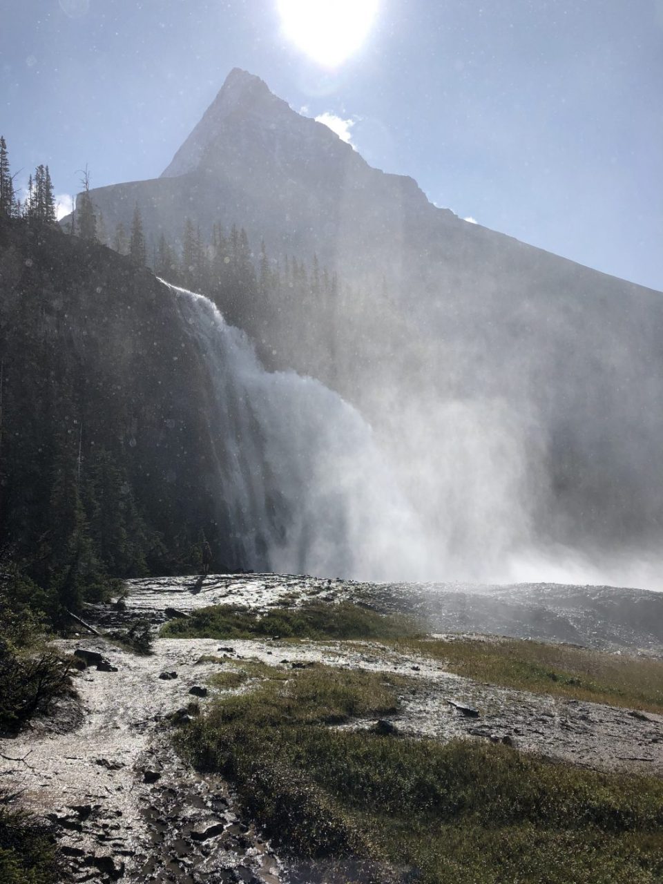
- at this point, the challenging part of the hike began with 5 km of uphill grunting and 500 meters of elevation gain, which was offset by some beautiful falls including the spectacular Emperor Falls near the top of the climb
- the next 5 km was relatively flat to our campsite at Berg Lake
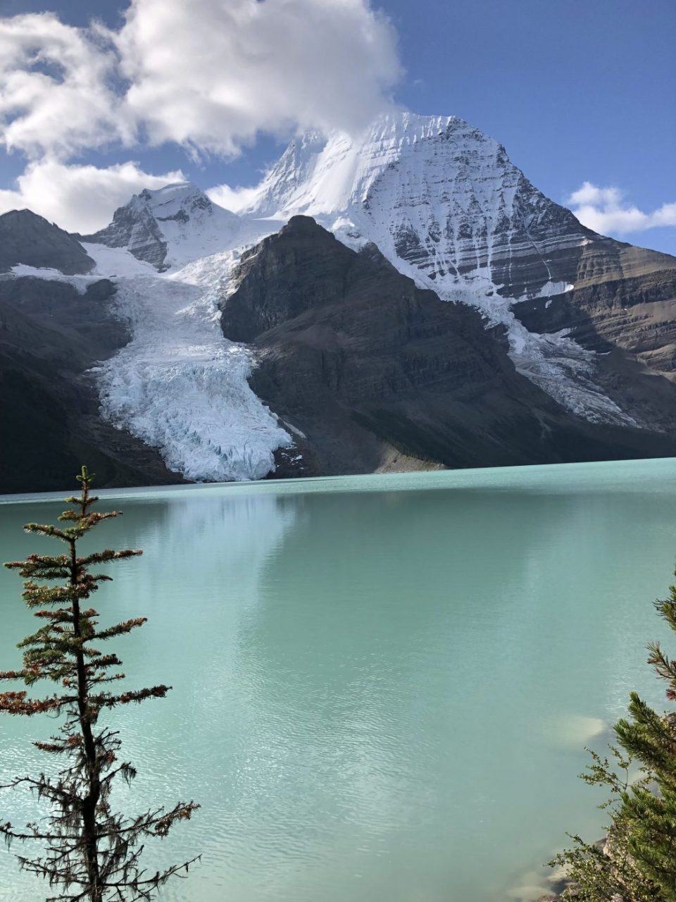
- the last 2 km open up with views of Berg Lake and Mt. Robson
- the hike took 6 hours for most of the group and 7 hours for some due to a muscle cramping issue for one of the gang
- the total elevation gain is 800 meters
- it was a long bike/hike, but I felt pretty good despite carrying a bigger pack than on our usual weekend day hikes
Day 2:
- in the morning we hiked up Toboggan Falls which was a steep ascent, but we made frequent stops to enjoy the many unique parts of the falls
- from here the trail to Mumm Basin was closed due to rock avalanche danger, so we ventured thru the forest towards Hargreaves Lake and Glacier
- this section had some beautiful wildflowers and great views of Berg Lake and Mt. Robson as the sun appeared sporadically along with low lying clouds which made for a great mystic feeling
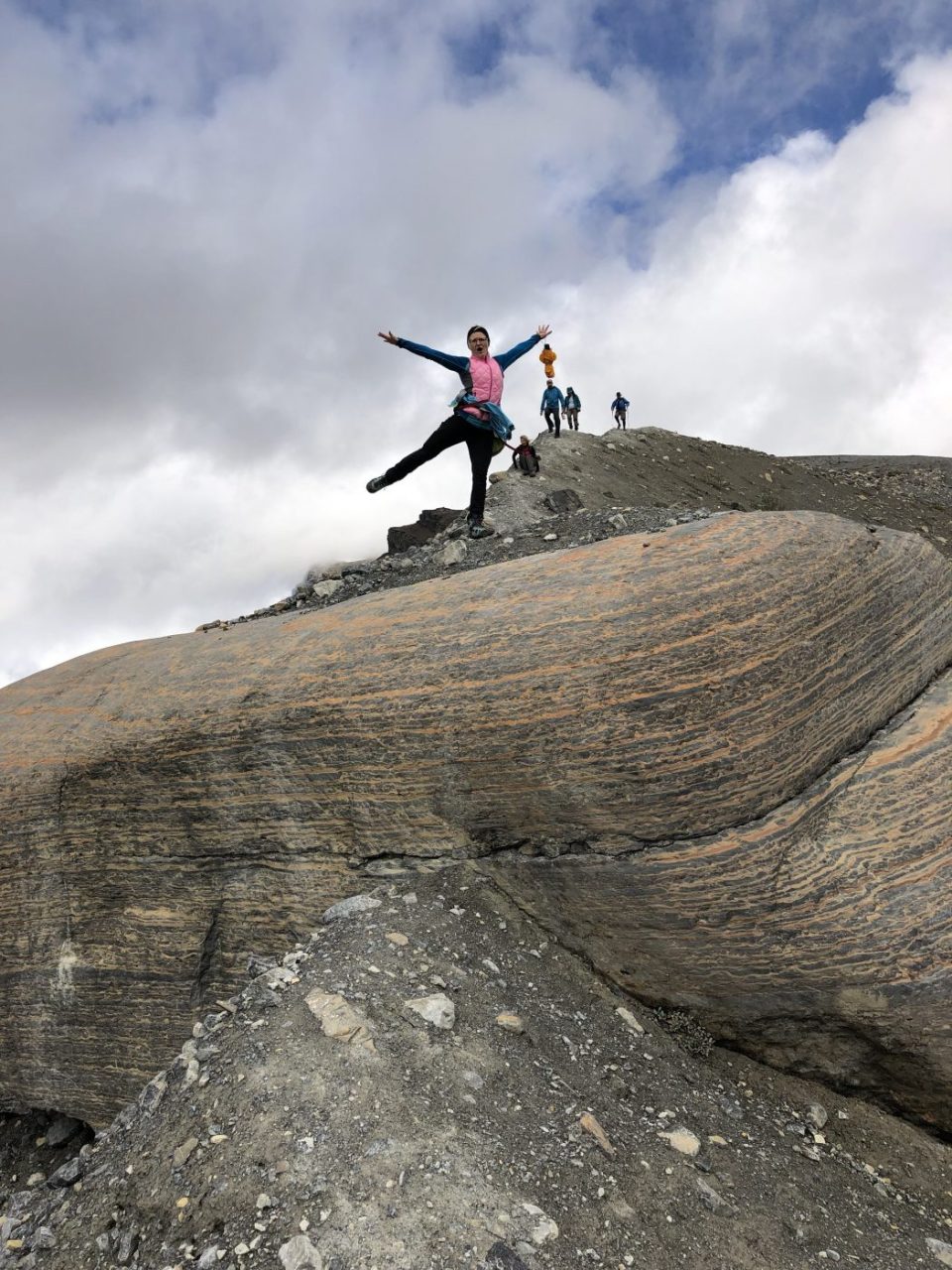
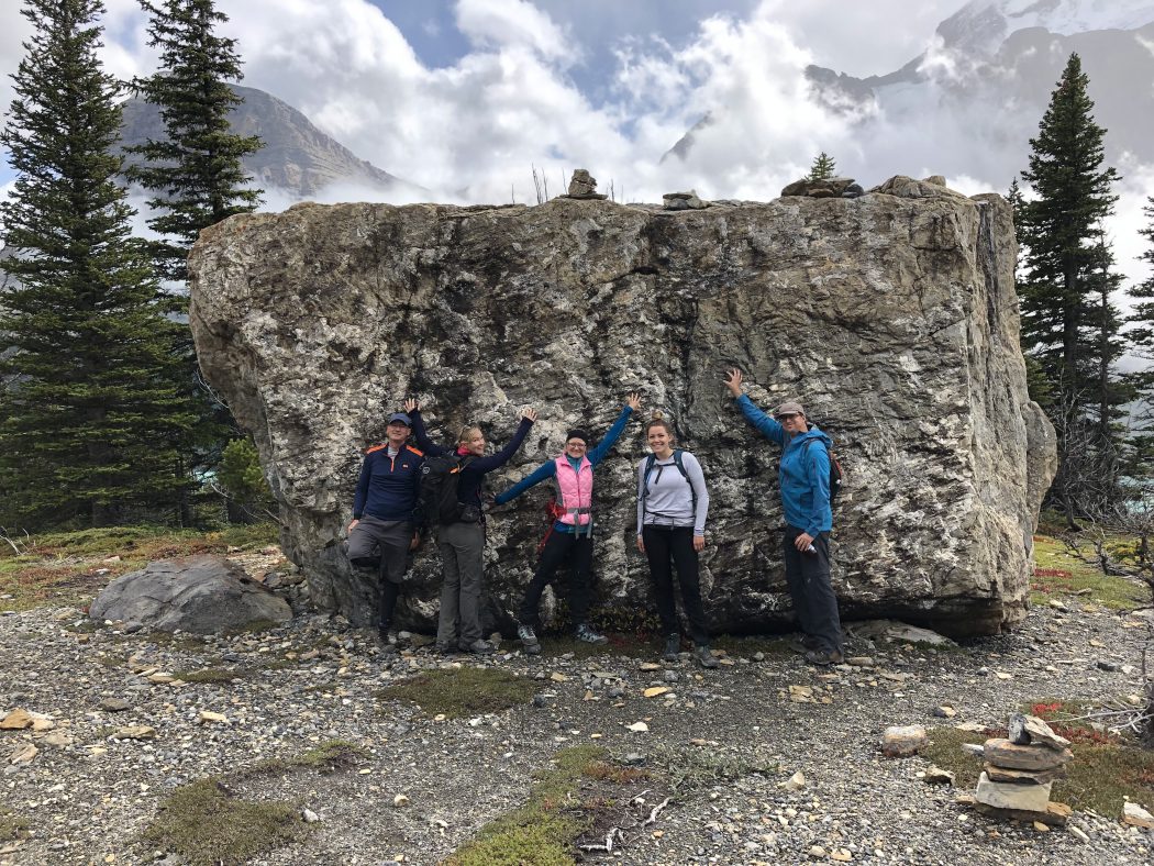
- as we approached Hargreaves Lake we climbed up to a ridge where we descended a steep scree slope down to a huge boulder than we unsuccessfully tried to climb aboard for the ultimate Instagram pic
- once we descended to Berg Lake it was a gentle stroll back to our campsite
- the total distance was 6 km and 300 meters of elevation gain
- in the afternoon we took the flat and leisurely walk out past the helicopter pad to Adolphus Lake which was 6 km round trip and it took us a little over an hour at a very leisurely pace
Day 3:
- this was our most grueling day as we did the 22 km trek up to Snowbird Pass over 800 meters and seven hours
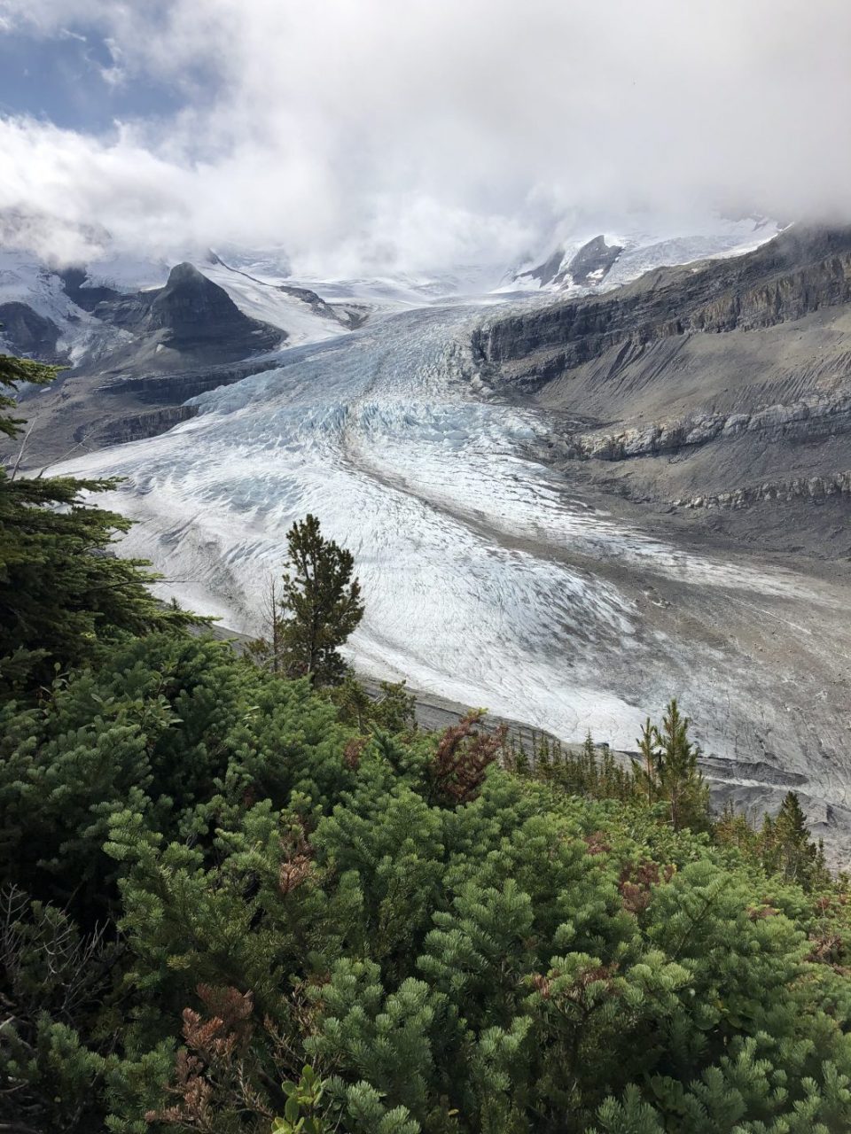
- the trail starts out gently making its way around Rearguard Mountain along Robson River to the backside of Mt. Robson where the expansive Mt. Robson glacier quickly comes into view and remains part of the visual pleasure of this trail for several km
- a few km into the hike there is a steep ascent up the Robson moraine on the north side of the valley including a narrow chained ridge that provides a mental challenge due to the steepness of the drop-off
- you gain 500 meters of elevation before reaching an expansive meadow area for the next few km and another 100 meters of elevation
- the last 2 km climbs sharply up 200 meters to Snowbird Pass where we were greeted with the massive expanse of the Reef Icefield that connects to the Coleman Glacier (an amazing site despite the inclement weather at the pass)
- my legs were burning up this last section, and we had a brief snowstorm that added to the challenge
- Michael and Rohan had done this hike the day before us, and they came across a group of mountain goats that ran back and forth across the trail right in front of them
- this trail does not open until July 1 to protect the caribou calving grounds in the area
Day 4:
- before the hike, a few of us had to carry our helicopter bags 2.5 km to the helipad and this gave us a new appreciation for what Feiko had gone thru a few days earlier
- my rainproof Patagonia bag with backpack straps sounds good in theory, but I had a sore neck after walking this short distance with it
- because of the trek to the helipad and back, the trek out was a 19 km hike and 7 km bike ride
- mother nature did us a huge favor with clear skies and hence a view of the top of Mt. Robson
- the walk along Berg Lake was a bit cool due to the wind, but it quickly warmed up once we descended into the forest towards Emperor Falls
- Emperor Falls is one of the nicest falls I have experienced as it drops several hundred feet before crashing down and creating a mist that extends several hundred feet beyond the base of the falls
- the steep downhill was easy on the cardio but put some pressure on the joints for those with knee or other leg issues
- we were all glad to make it to our bikes and hop on for the final 7 km where we mostly coasted down the trail although there was a throng of day hikers that did not appreciate 10 bikes motoring past them (good job by Gerard not to duke it out with the rude Italian gent that yelled at him)
Interesting notes:
- the park was established in 1913 which is the same year that the first ascent of Mt. Robson was made by a party led by Conrad Kain
- the area is designated a World Heritage site and is the second oldest provincial park in Canada
- Mt. Robson is the highest peak in the Canadian Rockies at 3954 meters (12,972 feet) and as a result, forms its own weather patterns
- people travel from around the world to experience this hike
- there are four campsites with 98 tent pads along the 23 km route to the last site at Robson Pass
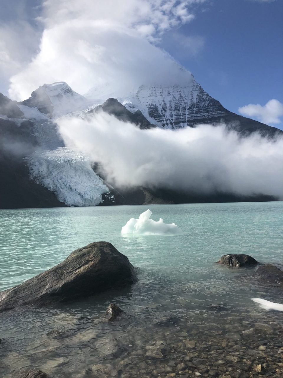
- Berg glacier had junks of ice falling off that made thunderous sounds at various points throughout the day and night and resulted in interesting shaped icebergs floating across the lake (the name Berg is a result of these icebergs)
- we had various injuries (two Achilles strains, ankle bruise, blisters, muscle cramping, oxygen deprivation, shoulder pain) that the group muscled their way thru without any major incidents
- the temperature dropped to around 7C at night, so it was fairly comfortable sleeping conditions
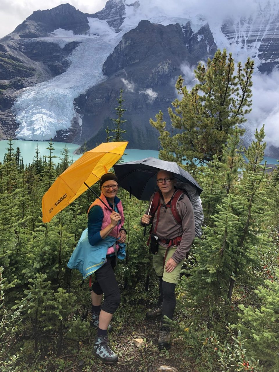
- we had rain off and on the first three days, but I avoided wearing rain pants or a rain jacket due to Sasha’s soon to be famous umbrella hiking technique
- the Hargreaves log cook cabin shelter at our campground was nice to have access to given the wet conditions although it was quite dark at certain times of the day, so a better lighting system is on the checklist for the next outing
- we enjoyed sitting on the front porch relaxing, reading, eating, sipping libations, watching a deer stroll by, and watching icebergs fall off the Berg Lake glacier
- after three days of rain and wet gear, one of the campers designated it an ‘emergency’ and lit a fire in the shelter to the joy of everyone
- we met some nice folks from France, Germany, Montreal, Eastern U.S. as well as local Western Canada people
- there were kids as young as seven years old that had made the journey with their parents
- this was my first backcountry hiking experience where I slept in a tent as my previous experiences were skiing into backcountry lodges
- in total, we hiked 67 km and biked 14 km over the four days
- thanks so much to Sasha for getting on the booking on day one of the reservation season on Oct 1 so that we could enjoy this slice of heaven