July 7, 2019
In
Outdoor Edventures
Buller Pass Loop Trail
Where:
- Buller Pass
When:
- June 29, 2019
Who:
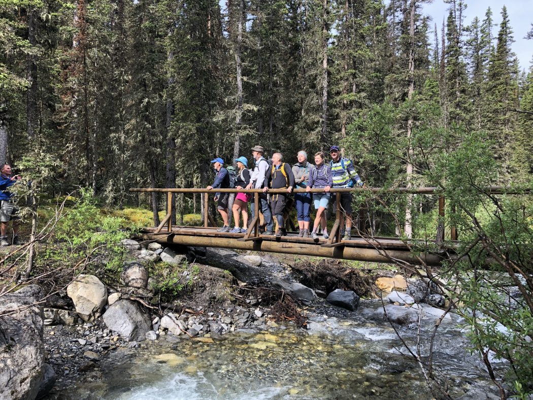
- Ed, Joey, Dave, Lorna, Geoff, Lynn, Ian, Lisa, Chris, Finn, Winnie, Noel
Trailhead:
- the trail starts at the Buller Mountain Day Use Area which is 30 km from Canmore on the Spray Lakes Road
- park on the entrance road to the day use area which is on the right (west) hand side of the road
- the trailhead is straight across the road on the east side
Degree of difficulty:
- 1300 meters of elevation gain and 20 km distance to do the loop around Buller Mountain
- the trail is relatively easy to follow although you have to be careful where it intersects the High Rockies trail in two spots near the beginning
- 4 km up the valley (just across the fourth bridge) you take the fork to the right to do the trail in a counterclockwise direction
- the climb to the first pass is steep but only takes 20 minutes
- at the top of the pass, the trail drops down a hundred meters and then across a rock area before you meander up into the valley around the back side of Buller Mountain
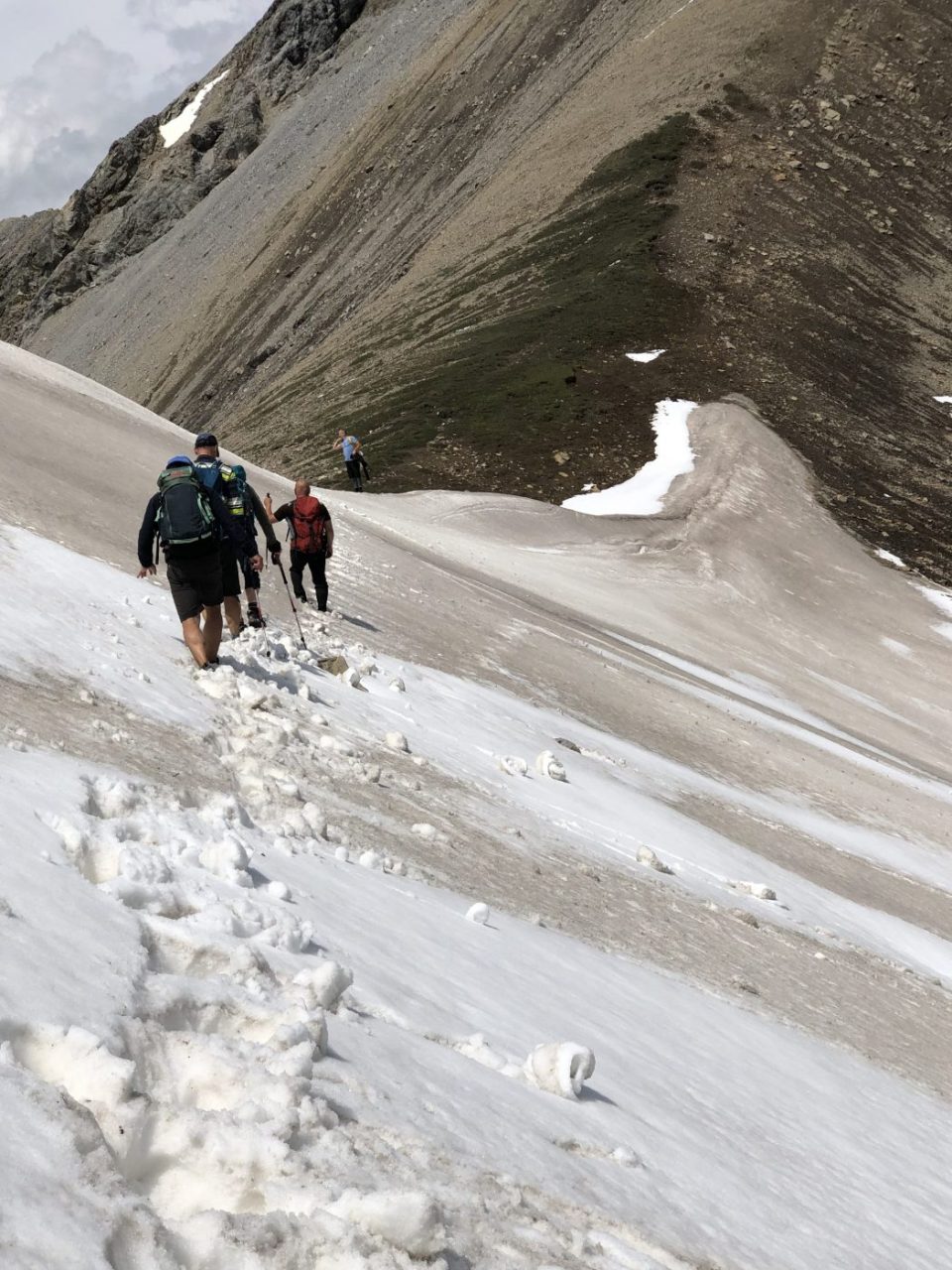
- there is another climb out of the valley before you descend a steep switchback on the north side of Buller Mountain
- on this particular day, we encountered numerous snow chutes on the back (north) side of Buller Mountain which made for a tricky ascent to the second pass, and we triggered a small avalanche on one of the chutes
- the hike took us five and a half hours and had several climbs that made it a tiring day
Interesting notes:
- on our way to the trailhead we encountered a young black bear (probably 6-7 months old), that was seemingly orphaned from its mother and kept crossing back and forth across the road in a distressed manner
- partway up the forested valley, there are several unique trees that have multiple trunks (still a mystery to me how they are formed)
- the wildflowers added some nice color to certain sections of the hike
- as well there are several burnt areas in the valley where they have been trying to control the spread of the pine beetle
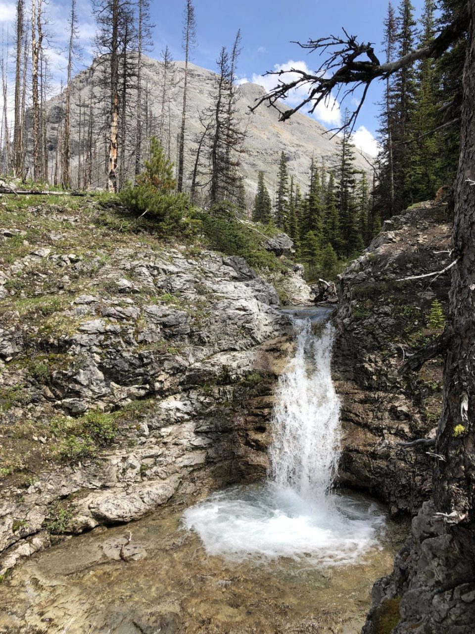
- around the 4 km mark, there is a beautiful waterfall in Buller Creek that is worth stopping to enjoy for a few minutes
- there are a few other waterfalls on this trail that are also quite impressive
- in the meadow before the ascent to the first pass there was a huge area where bears had dug up the ground looking for ground squirrels
- the views are tremendous once you break out of the forested area with Buller Mountain to the north and east and Mt. Engadine to the south
- at the pass, you look across the valley to Mt. Kidd and Guinn Lake, down to Ribbon Lake and Mt. Bogart off to the left (north)