August 14, 2020
In
Outdoor Edventures
Angel Springs Hike
Where:
- Angel Springs
When:
- August 14, 2020
Who:
- Ed, Jace, Jamie
Trailhead:
- 18 km from downtown Kelowna (about a 30-minute drive)
- located in S.E. Kelowna
- take KLO road from downtown Kelowna then take the Y intersection right hand turn to McCullough Road towards Gallagher’s Canyon and turn right onto June Springs Rd which turns into Little White Forest Service Rd (1 km along LWFS to the trailhead)
- the trailhead parking is on the right-hand side
- the trailhead is across the road and up 50 feet on the left-hand side (we made the mistake of taking the trail out of the far end of the parking lot which is the Myra Bailout trail and hence tacked on an extra 2 km before realizing we were on the wrong trail)
Degree of difficulty:
- 6.4 km round trip
- the trail is up and down with an overall elevation gain of 140 meters, but it drops 70 meters into the canyon bottom to the tuja deposits
- the net result is 240 meters of climbing on the out and back
- we spent two hours on the trail at a leisurely pace
Interesting notes:
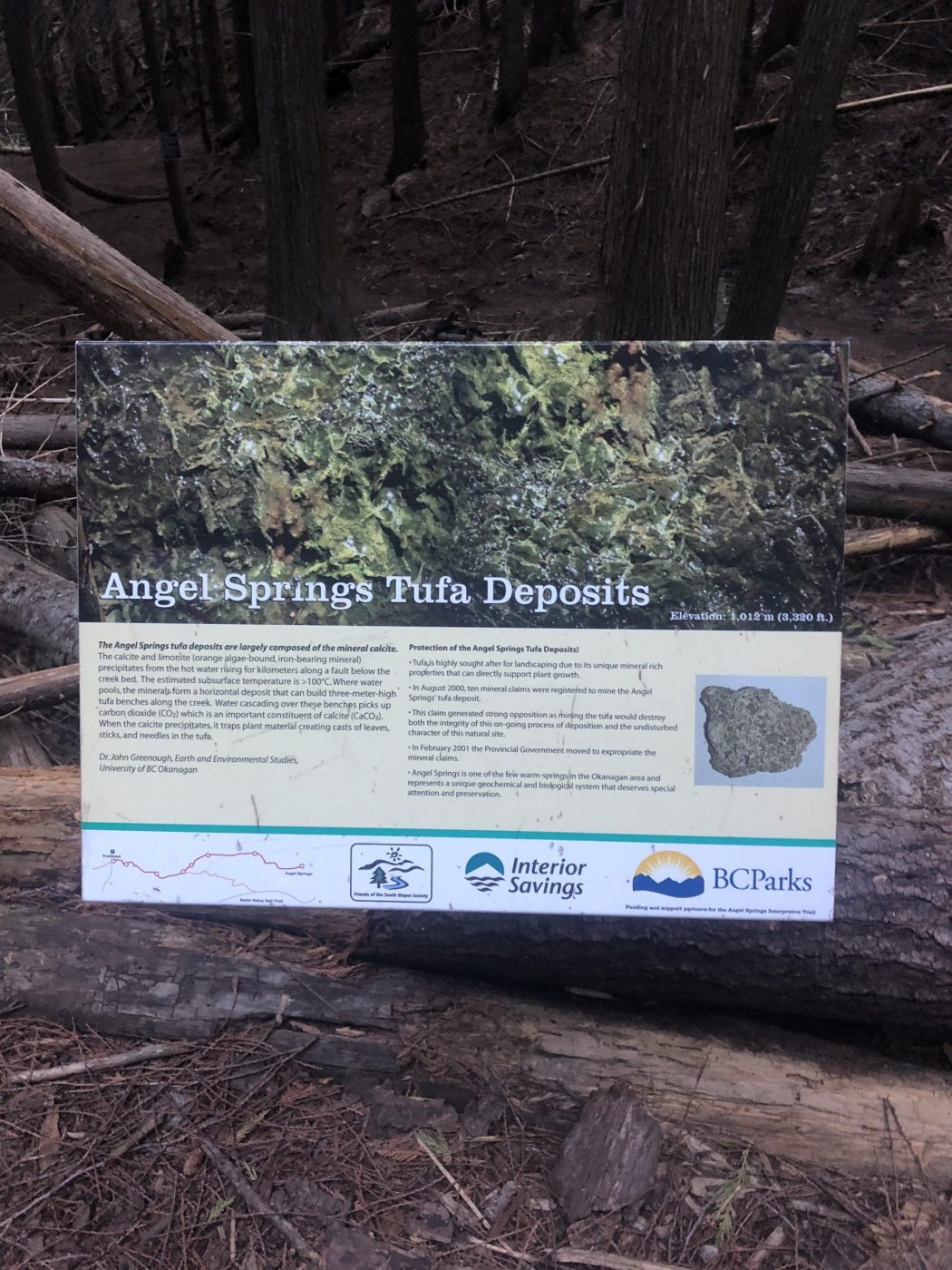
- there are numerous trail signs explaining the ecology of the area which makes this trail more exciting given the limited views from the coniferous forest
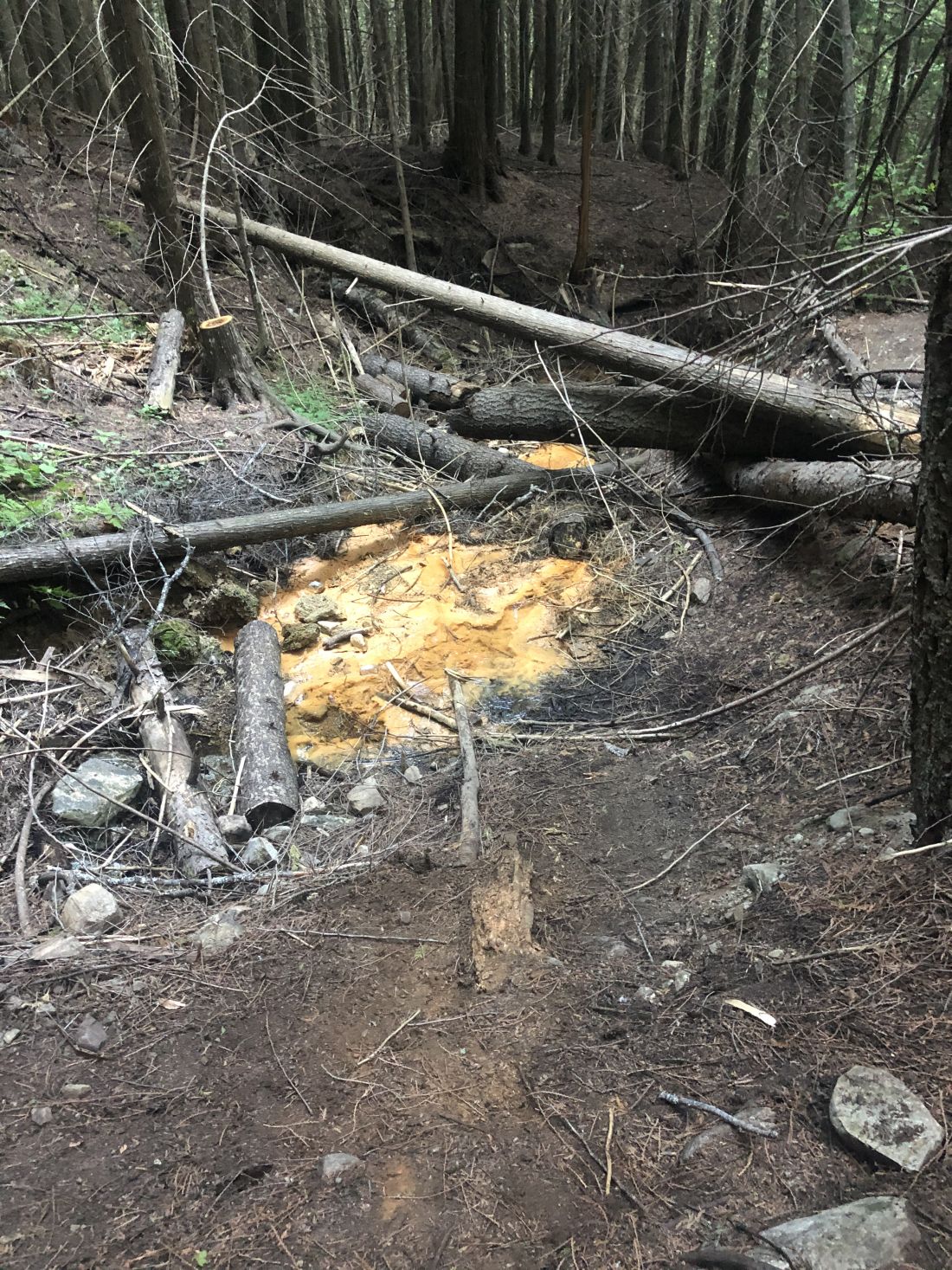
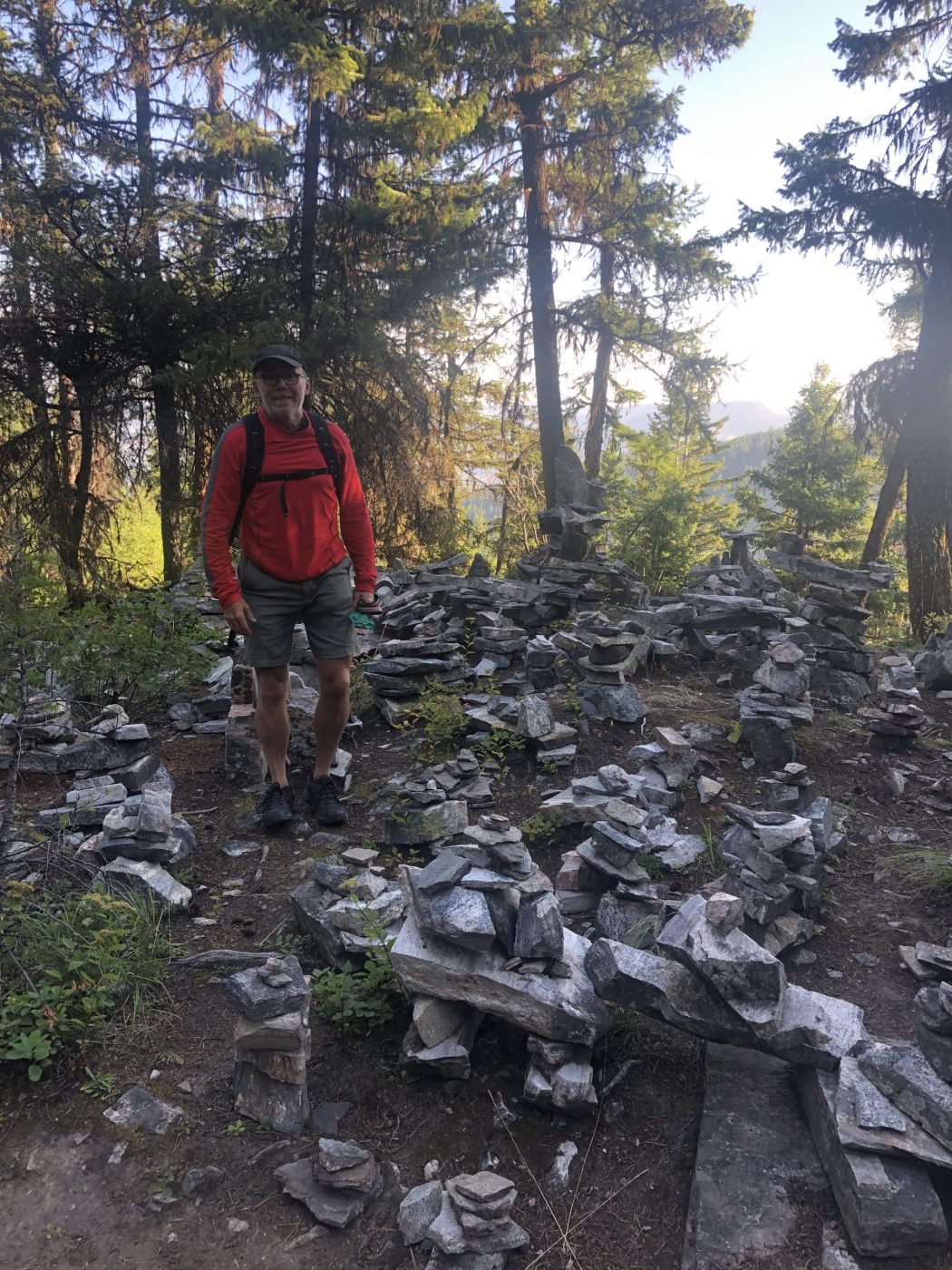
- the highlights include a field of Inukshuks, seasonal wetlands, Gneiss rock formations, a fire break, brief views of Myra Canyon, various tree species, and the tufa springs
- the tufa springs are 100C below the surface, but only 25C on the surface and can be identified by orange-colored tufa deposits (tufa is a mineral that is formed when calcite crystallizes after water evaporation and is highly sought after for landscaping due to its unique mineral-rich properties)
- the springs were first discovered in the 1960s when local resident Ben Schleppe discovered a plume of steam coming out of the creek and after this, he hand-cut a trail
- there is an alternate route that starts on the Myra Forest Service Road via KLO creek and is 10 km out and back